
The CCTV data feed provides details on UTMC CCTV camera naming, locations & still images. CCTV data is split across 3 feeds and presented as JSON and JPEG.
CCTV Static
The static CCTV data provides information on all CCTV configured on the UTMC system for public viewing. The data for static feed includes:
- systemCodeNumber – Unique CCTV ID
- definitions:
- shortDescription – Short CCTV name
- longDescription – Full CCTV name
- point – Location
- easting/northing – EPSG:27700 (OSGB 1936 / British National Grid)
- latitude/longitude – EPSG:3857 (WGS 84 / Pseudo-Mercator)
- lastUpdated – Date & Time (ISO 8601) definition was updated
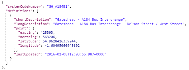
Example of an asset from CCTV Static
CCTV Dynamic
The dynamic CCTV data provides live information on all CCTV configured on the UTMC system for public viewing. The data for dynamic feed includes:
- systemCodeNumber – Unique CCTV ID
- dynamics:
- image – The URL to the JPEG
- lastUpdated – Date & Time (ISO 8601) definition was updated, normally every 60-300 seconds.
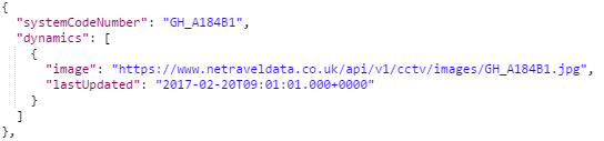
Example of an asset from CCTV Dynamic
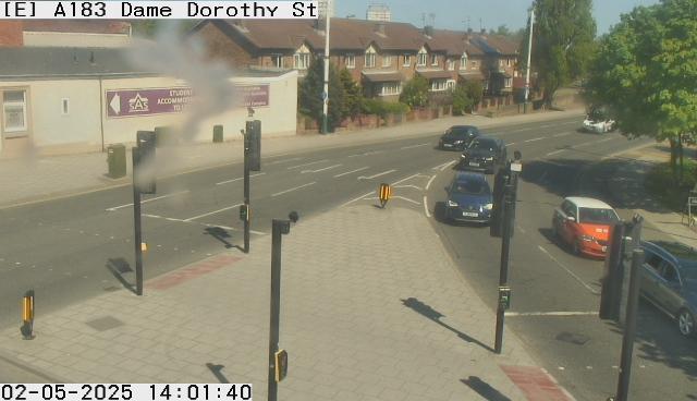
CCTV Images
The CCTV images data provides the latest JPEG of each CCTV asset as described in the dynamic feed.
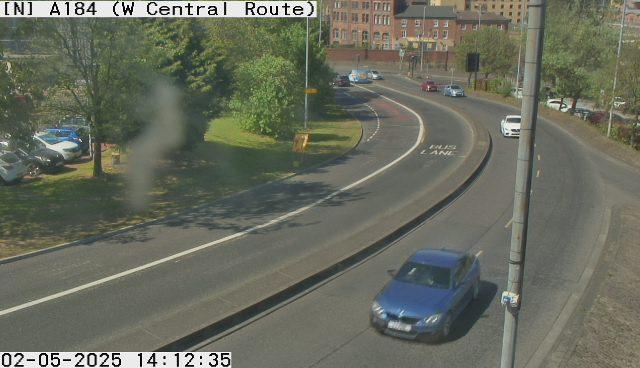
Example of an asset from Car Park Images
Further Information
The frequency that the CCTV Images are refreshed is dependant on the ownership of the camera concerned. Each image contains a superimposed time-stamp.
UTMC Cameras
- systemCodeNumber starts with:
- GH (Gateshead)
- MC (Metrocentre)
- NB (Northumberland)
- NC (Newcastle-upon-Tyne)
- NT (North Tyneside)
- PS (Public Safety joint use)
- SL (Sunderland)
- ST (South Tyneside)
- JPEG image at 640×480 pixels or 1280×720 pixels
- Updated every 60-300 seconds approximately
- Example: SL_A1018E1
Tyne Tunnel Cameras
- systemCodeNumber starts with TT2
- JPEG image at 352×288 pixels
- Updated every 60 seconds approximately
- Example: TT2North1

Vaisala Cameras
- systemCodeNumber starts with METCCTV or VAISALACCTV
- JPEG image at 640×480 pixels
- Updated every 900-1800 seconds approximately
- Examples: METCCTV00002, VAISALACCTV12
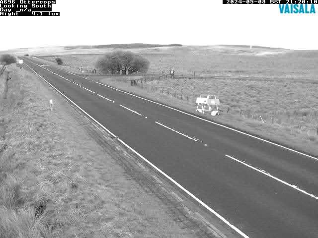
Image Content
UTMC cameras are set up with several default positions which tour/move to each position every 60-300 seconds depending on the camera’s strategic importance. On each position move in the tour, the camera sends back a JPEG image which is then published on the feed. The aspect shown is likely to differ from each returned JPEG to give a different perspective at the location.
If the camera has a pan, tilt and zoom (PTZ) facility and is under the control of an operator, the JPEG will not be returned. UTMC/Public Safety joint usage cameras stop returning JPEG’s Monday-Friday 23:00-06:30, Saturday & Sunday 23:00-07:00.
Tyne Tunnel & Vaisala cameras are fixed and will always send JPEG’s unless offline.
All cameras are used for traffic management purposes only. In-keeping with best practice nationally, and guidance from the Information Commissioner, no images are recorded and all files are overwritten.
Full information on the content of these feeds can be found in the API document located here.
Examples
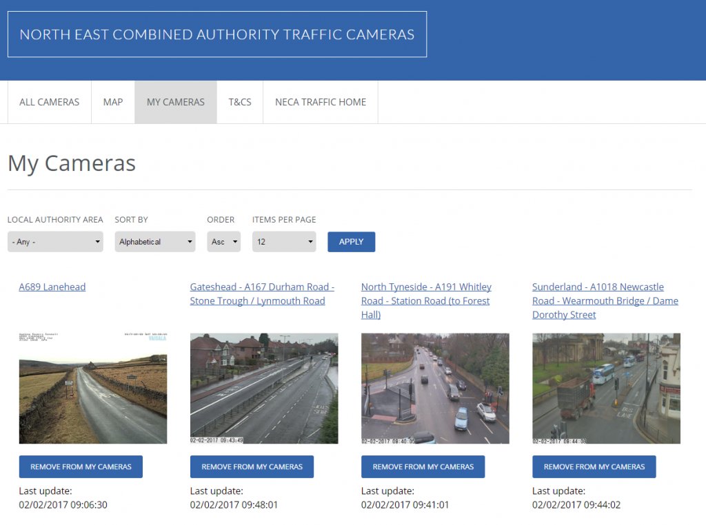
You can view the following examples which use these feeds in some form. If you would like us to consider your application or service to be featured on this page please comment below.
Newcastle University’s Urban Observatory – https://api.newcastle.urbanobservatory.ac.uk/camera
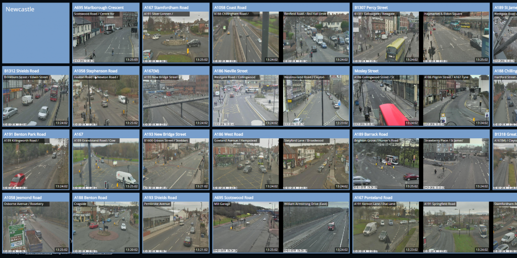
North East Traffic Cameras – www.netrafficcams.co.uk
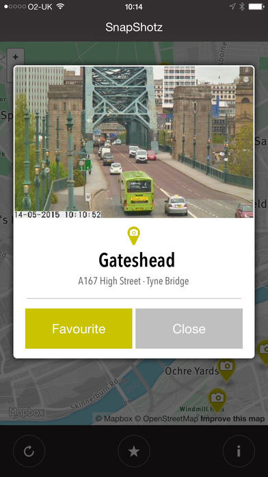
SnapShotz – iOS
Hi,
I have some questions relating to the “Plates In” and “Plates Out” datasets using ANPR cameras, is this the right place for them?
Each sensor ID includes 2 locations, the first is the camera site for the Plates In data, and the second is the site for Plates Out. But there seems to be some duplication, e.g. the same locations are sometimes used for Plates In under multiple sensor IDs. But when this happens, the traffic flows are not always identical between these duplicated camera locations. Are they perhaps viewing different lanes of the same road at the same point?
It’s also often unclear whether a camera is covering the whole road, or just one of the lanes.
Also, it would be really helpful to get some clearer information on the ANPR camera locations. I can see lat/long coordinates, but not street names or numbers, so it’s not always clear to me which street they are covering.
Finally, there are periods when the cameras seem to be only partially active, and are not counting every single vehicle plate that passes by. At other times there are gaps of several hours, followed by a very high reading that seems to be a cumulative sum of all of the vehicles that passed by in those missing hours. I can’t see a way of telling when the cameras are partially or fully active, or how frequent the readings should be under normal conditions (roughly every 5 minutes it seems).
I have some questions relating to the “Plates In” and “Plates Out” datasets using ANPR cameras, is this the right place for them?
Each sensor ID includes 2 locations, the first is the camera site for the Plates In data, and the second is the site for Plates Out.
The plates in value is the start of the journey time link, plates out the end of the journey time link.
But there seems to be some duplication, e.g. the same locations are sometimes used for Plates In under multiple sensor IDs. But when this happens, the traffic flows are not always identical between these duplicated camera locations.
Several journey time links may use the same start location but have different end locations. These may also use a different set of cameras used at the locations.
Are they perhaps viewing different lanes of the same road at the same point?
This data varies per location and link.
It’s also often unclear whether a camera is covering the whole road, or just one of the lanes.
This data is not available via open data and varies per location and link.
Also, it would be really helpful to get some clearer information on the ANPR camera locations. I can see lat/long coordinates, but not street names or numbers, so it’s not always clear to me which street they are covering.
This data is available via open data on the static feed for journey times (https://www.netraveldata.co.uk/api/v2/journeytime/static). You will see a full name of the street name in the longDescription and Easting/Northing and Lat/Long.
Finally, there are periods when the cameras seem to be only partially active, and are not counting every single vehicle plate that passes by.
There are sometimes site works, roadworks, communication faults. Weather conditions also affect plate reads.
At other times there are gaps of several hours, followed by a very high reading that seems to be a cumulative sum of all of the vehicles that passed by in those missing hours.
If there is a communications break, the build up of number plate reads during the outage will be sent to the system in on batch when communications are restored. Late at night/early morning, fewer plate reads are possible so journey time link may become unreliable.
I can’t see a way of telling when the cameras are partially or fully active, or how frequent the readings should be under normal conditions (roughly every 5 minutes it seems).
Active/inactive status is not available via Open Data. Reads for UTMC journey time links (starting CAJT_) are every 4 minutes.